
Thank you for supporting this site ❤️
Make a donation
Make a donation
Gennevilliers topographic map
Click on the map to display elevation.
Thank you for supporting this site ❤️
Make a donation
Make a donation
About this map
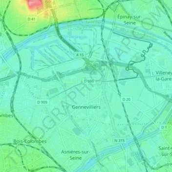
Name: Gennevilliers topographic map, elevation, terrain.
Average elevation: 36 m
Minimum elevation: 17 m
Maximum elevation: 118 m
Thank you for supporting this site ❤️
Make a donation
Make a donation
Other topographic maps
Click on a map to view its topography, its elevation and its terrain.
Thank you for supporting this site ❤️
Make a donation
Make a donation
Parc de Billancourt
France > Ile-de-France > Hauts-de-Seine > Boulogne-Billancourt
Average elevation: 58 m
Val Saint-Olaf
France > Ile-de-France > Hauts-de-Seine > Chaville > Val Saint-Olaf
Average elevation: 128 m