
Thank you for supporting this site ❤️
Make a donation
Make a donation
Westwood Hills topographic map
Click on the map to display elevation.
Thank you for supporting this site ❤️
Make a donation
Make a donation
About this map
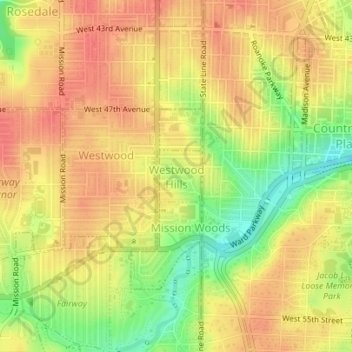
Name: Westwood Hills topographic map, elevation, terrain.
Location: Westwood Hills, Johnson County, Kansas, United States (39.03696 -94.61188 39.04094 -94.60741)
Average elevation: 286 m
Minimum elevation: 252 m
Maximum elevation: 304 m
Thank you for supporting this site ❤️
Make a donation
Make a donation
Other topographic maps
Click on a map to view its topography, its elevation and its terrain.
Thank you for supporting this site ❤️
Make a donation
Make a donation
Overland Park Arboretum and Botanical Gardens
United States > Kansas > Johnson County > Overland Park
Average elevation: 305 m
Thank you for supporting this site ❤️
Make a donation
Make a donation
Thank you for supporting this site ❤️
Make a donation
Make a donation