
Tendring topographic map
Click on the map to display elevation.
About this map
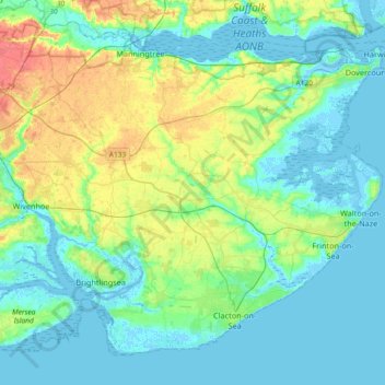
Name: Tendring topographic map, elevation, terrain.
Location: Tendring, Essex, England, United Kingdom (51.76753 0.93110 51.95963 1.29659)
Average elevation: 14 m
Minimum elevation: -4 m
Maximum elevation: 53 m