
Keriguy topographic map
Interactive map
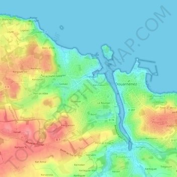
Click on the map to display elevation.
About this map
Name: Keriguy topographic map, elevation, terrain.
Average elevation: 31 m
Minimum elevation: 0 m
Maximum elevation: 88 m
Other topographic maps
Click on a map to view its topography, its elevation and its terrain.
Kermabon
Frankreich > Bretagne > Finistère > Douarnenez
Kermabon, Douarnenez, Quimper, Finistère, Bretagne, Metropolitanes Frankreich, 29100, Frankreich
Average elevation: 28 m