
Thank you for supporting this site ❤️
Make a donation
Make a donation
Gouraya topographic map
Click on the map to display elevation.
Thank you for supporting this site ❤️
Make a donation
Make a donation
About this map
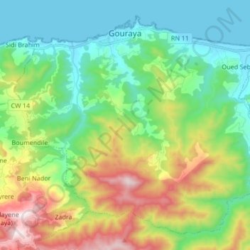
Name: Gouraya topographic map, elevation, terrain.
Location: Gouraya, Gouraya District, Tipaza, 42007, Algeria (36.48510 1.84613 36.57942 1.98040)
Average elevation: 309 m
Minimum elevation: -1 m
Maximum elevation: 997 m
Thank you for supporting this site ❤️
Make a donation
Make a donation
Other topographic maps
Click on a map to view its topography, its elevation and its terrain.