
Thank you for supporting this site ❤️
Make a donation
Make a donation
Villaverde topographic map
Click on the map to display elevation.
Thank you for supporting this site ❤️
Make a donation
Make a donation
About this map
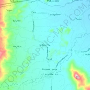
Name: Villaverde topographic map, elevation, terrain.
Location: Villaverde, Nueva Vizcaya, Cagayan Valley, Philippines (16.56506 121.14360 16.64506 121.22360)
Average elevation: 273 m
Minimum elevation: 214 m
Maximum elevation: 592 m
Thank you for supporting this site ❤️
Make a donation
Make a donation
Other topographic maps
Click on a map to view its topography, its elevation and its terrain.