
Make a donation
Kermanshah topographic map
Click on the map to display elevation.
Make a donation
Kermanshah
Kermanshah has a climate which is heavily influenced by the proximity of the Zagros mountains, classified as a hot-summer Mediterranean climate (Csa). The city's altitude and exposed location relative to westerly winds makes precipitation a little bit high (more than twice that of Tehran), but at the same time produces huge diurnal temperature swings especially in the virtually rainless summers, which remain extremely hot during the day. Kermanshah experiences rather cold winters and there are usually rainfalls in fall and spring. Snow cover is seen for at least a couple of weeks in winter.
Make a donation
About this map
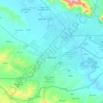
Name: Kermanshah topographic map, elevation, terrain.
Average elevation: 1,416 m
Minimum elevation: 1,286 m
Maximum elevation: 2,318 m
Make a donation
Other topographic maps
Click on a map to view its topography, its elevation and its terrain.