
Banaban topographic map
Click on the map to display elevation.
About this map
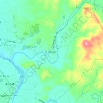
Name: Banaban topographic map, elevation, terrain.
Location: Banaban, Angat, Bulacan, Central Luzon, Philippines (14.92040 121.02596 14.96040 121.06596)
Average elevation: 55 m
Minimum elevation: 18 m
Maximum elevation: 144 m
Other topographic maps
Click on a map to view its topography, its elevation and its terrain.