
Thank you for supporting this site ❤️
Make a donation
Make a donation
Shotton topographic map
Click on the map to display elevation.
Thank you for supporting this site ❤️
Make a donation
Make a donation
About this map
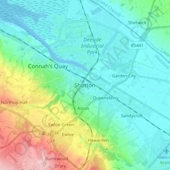
Name: Shotton topographic map, elevation, terrain.
Location: Shotton, Flintshire, Wales, CH5 1BF, United Kingdom (53.17073 -3.07716 53.25073 -2.99716)
Average elevation: 37 m
Minimum elevation: -1 m
Maximum elevation: 161 m
Thank you for supporting this site ❤️
Make a donation
Make a donation
Other topographic maps
Click on a map to view its topography, its elevation and its terrain.