
Ciudad Valles topographic map
Interactive map
Click on the map to display elevation.
About this map
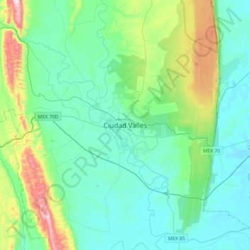
Name: Ciudad Valles topographic map, elevation, terrain.
Location: Ciudad Valles, San Luis Potosí, 79000, Mexiko (21.83166 -99.17030 22.15166 -98.85030)
Average elevation: 181 m
Minimum elevation: 23 m
Maximum elevation: 841 m
Die Stadt Ciudad Valles liegt in der Küstenregion der Huasteca in einer mittleren Höhe von ca. 125 m. Bis zur Stadt San Luis Potosí, der Hauptstadt des Bundesstaates, sind es ca. 255 km (Fahrtstrecke) in westlicher Richtung; die an der Küste des Golfs von Mexiko gelegene Stadt Tampico ist ca. 140 km in östlicher Richtung entfernt. Das Klima ist tropisch schwül bis heiß; Regen (ca. 1200 mm/Jahr) fällt hauptsächlich im Sommerhalbjahr.