
Heidenrod topographic map
Click on the map to display elevation.
About this map
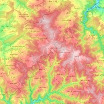
Name: Heidenrod topographic map, elevation, terrain.
Location: Heidenrod, Rheingau-Taunus-Kreis, Hesse, 65321, Germany (50.10390 7.88266 50.23876 8.04310)
Average elevation: 398 m
Minimum elevation: 183 m
Maximum elevation: 547 m
Other topographic maps
Click on a map to view its topography, its elevation and its terrain.
Wehener Wand und Rentmauer Wiesbaden
Germany > Hesse > Rheingau-Taunus-Kreis > Wiesbaden
Average elevation: 377 m