
Thank you for supporting this site ❤️
Make a donation
Make a donation
Netailove topographic map
Click on the map to display elevation.
Thank you for supporting this site ❤️
Make a donation
Make a donation
Netailove
The elevation of the village is 175 meters.
Thank you for supporting this site ❤️
Make a donation
Make a donation
About this map
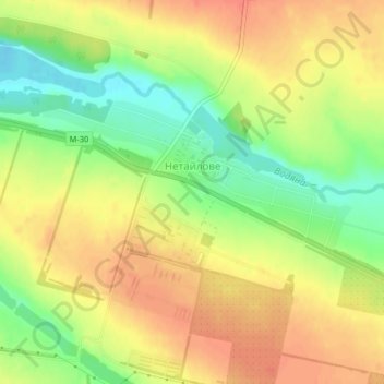
Name: Netailove topographic map, elevation, terrain.
Average elevation: 165 m
Minimum elevation: 136 m
Maximum elevation: 186 m
Thank you for supporting this site ❤️
Make a donation
Make a donation