Geolocate

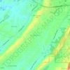
Wilton topographic map

Click on the map to display elevation.

About this map

Name: Wilton topographic map, elevation, terrain.

Location: Wilton, Shelby County, Alabama, 35787, United States (33.07394 -86.89021 33.08992 -86.86861)

Average elevation: 128 m

Minimum elevation: 105 m

Maximum elevation: 158 m

Other topographic maps

Click on a map to view its topography, its elevation and its terrain.
Scottsdale

United States > Alabama > Shelby County > Alabaster

Average elevation: 168 m

Valley Forge

United States > Alabama > Shelby County > Alabaster

Average elevation: 152 m

Maylene

United States > Alabama > Shelby County > Alabaster

Average elevation: 179 m

Meadowbrook

United States > Alabama > Shelby County

Average elevation: 192 m

Chandalar South

United States > Alabama > Shelby County > Pelham

Average elevation: 160 m

Abbot Springs

United States > Alabama > Shelby County > Westover

Average elevation: 163 m

Lawley

United States > Alabama > Shelby County

Average elevation: 168 m

Westover

United States > Alabama > Shelby County

Average elevation: 153 m

Hardy

United States > Alabama > Shelby County > Alabaster

Average elevation: 157 m

Meadowbrook

United States > Alabama > Shelby County > Meadowbrook

Average elevation: 192 m