
Thank you for supporting this site ❤️
Make a donation
Make a donation
Hoeselt topographic map
Click on the map to display elevation.
Thank you for supporting this site ❤️
Make a donation
Make a donation
About this map
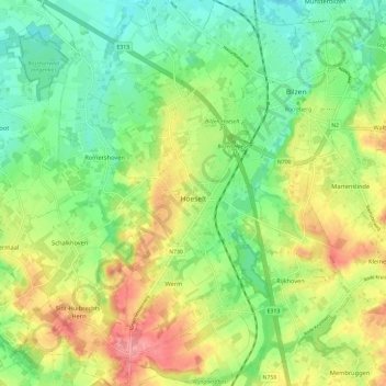
Name: Hoeselt topographic map, elevation, terrain.
Location: Hoeselt, Tongeren, Limburg, Flanders, Belgium (50.81374 5.42912 50.88843 5.51333)
Average elevation: 73 m
Minimum elevation: 37 m
Maximum elevation: 125 m
Thank you for supporting this site ❤️
Make a donation
Make a donation
Other topographic maps
Click on a map to view its topography, its elevation and its terrain.