
Thank you for supporting this site ❤️
Make a donation
Make a donation
San Fermin topographic map
Click on the map to display elevation.
Thank you for supporting this site ❤️
Make a donation
Make a donation
About this map
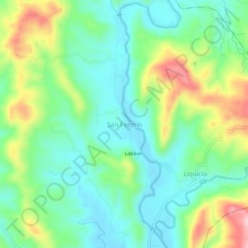
Name: San Fermin topographic map, elevation, terrain.
Location: San Fermin, Caba, La Union, Ilocos Region, Philippines (16.42490 120.37400 16.46490 120.41400)
Average elevation: 100 m
Minimum elevation: 24 m
Maximum elevation: 261 m
Thank you for supporting this site ❤️
Make a donation
Make a donation