
Thank you for supporting this site ❤️
Make a donation
Make a donation
Meyrin topographic map
Click on the map to display elevation.
Thank you for supporting this site ❤️
Make a donation
Make a donation
About this map
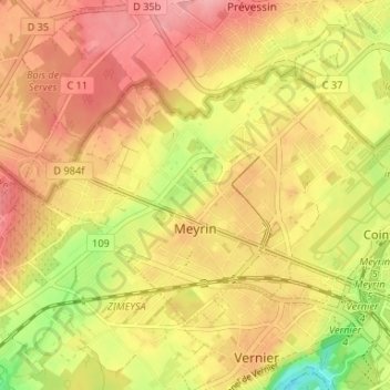
Name: Meyrin topographic map, elevation, terrain.
Location: Meyrin, Geneva, Switzerland (46.21717 6.04611 46.24713 6.11190)
Average elevation: 434 m
Minimum elevation: 366 m
Maximum elevation: 478 m
Thank you for supporting this site ❤️
Make a donation
Make a donation
Other topographic maps
Click on a map to view its topography, its elevation and its terrain.
Thank you for supporting this site ❤️
Make a donation
Make a donation
Le Grand-Saconnex
Switzerland > Geneva > Le Grand-Saconnex > Le Grand-Saconnex
Average elevation: 414 m
Thank you for supporting this site ❤️
Make a donation
Make a donation