
Thank you for supporting this site ❤️
Make a donation
Make a donation
Bishozi Ii topographic map
Click on the map to display elevation.
Thank you for supporting this site ❤️
Make a donation
Make a donation
About this map
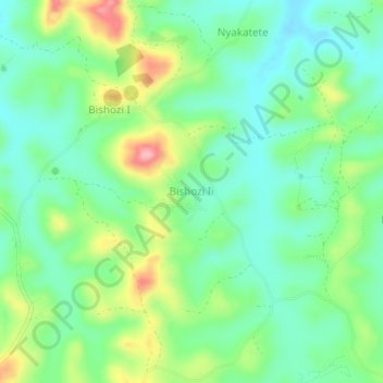
Name: Bishozi Ii topographic map, elevation, terrain.
Location: Bishozi Ii, Kazo, Western Region, Uganda (-0.04550 30.59593 -0.00550 30.63593)
Average elevation: 1,312 m
Minimum elevation: 1,266 m
Maximum elevation: 1,406 m
Thank you for supporting this site ❤️
Make a donation
Make a donation
Other topographic maps
Click on a map to view its topography, its elevation and its terrain.