
Albula topographic map
Interactive map
Click on the map to display elevation.
About this map
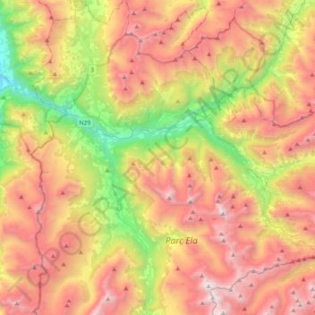
Name: Albula topographic map, elevation, terrain.
Location: Albula, Grisons, Suisse (46.57845 9.44940 46.71259 9.80843)
Average elevation: 2,008 m
Minimum elevation: 669 m
Maximum elevation: 3,372 m
Other topographic maps
Click on a map to view its topography, its elevation and its terrain.
Lenzerheide
Suisse > Grisons > Albula > Vaz/Obervaz
Lenzerheide, Vaz/Obervaz, Albula, Grisons, 7078, Suisse
Average elevation: 1,723 m
Lantsch/Lenz
Suisse > Grisons > Albula > Lantsch/Lenz
Lantsch/Lenz, Albula, Grisons, 7083, Suisse
Average elevation: 1,753 m