
Thank you for supporting this site ❤️
Make a donation
Make a donation
38790 topographic map
Click on the map to display elevation.
Thank you for supporting this site ❤️
Make a donation
Make a donation
About this map
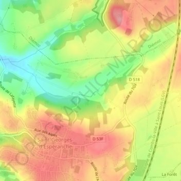
Name: 38790 topographic map, elevation, terrain.
Average elevation: 362 m
Minimum elevation: 250 m
Maximum elevation: 490 m
Thank you for supporting this site ❤️
Make a donation
Make a donation
Other topographic maps
Click on a map to view its topography, its elevation and its terrain.
La Grange Jassy
France > Auvergne-Rhône-Alpes > Isère > Saint-Georges-d'Espéranche
Average elevation: 335 m