
Thank you for supporting this site ❤️
Make a donation
Make a donation
Kallikkad topographic map
Click on the map to display elevation.
Thank you for supporting this site ❤️
Make a donation
Make a donation
About this map
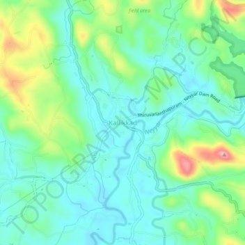
Name: Kallikkad topographic map, elevation, terrain.
Location: Kallikkad, Kattakkada, Thiruvananthapuram, Kerala, 695574, India (8.51085 77.10579 8.55085 77.14579)
Average elevation: 86 m
Minimum elevation: 44 m
Maximum elevation: 195 m
Thank you for supporting this site ❤️
Make a donation
Make a donation
Other topographic maps
Click on a map to view its topography, its elevation and its terrain.