
Thank you for supporting this site ❤️
Make a donation
Make a donation
Lovers Leap topographic map
Click on the map to display elevation.
Thank you for supporting this site ❤️
Make a donation
Make a donation
About this map
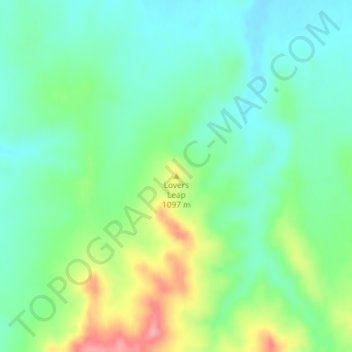
Name: Lovers Leap topographic map, elevation, terrain.
Location: Lovers Leap, Dawes County, Nebraska, United States (42.84131 -102.83106 42.84141 -102.83096)
Average elevation: 1,063 m
Minimum elevation: 1,030 m
Maximum elevation: 1,133 m
Thank you for supporting this site ❤️
Make a donation
Make a donation
Other topographic maps
Click on a map to view its topography, its elevation and its terrain.