
Thank you for supporting this site ❤️
Make a donation
Make a donation
Helmville topographic map
Click on the map to display elevation.
Thank you for supporting this site ❤️
Make a donation
Make a donation
About this map
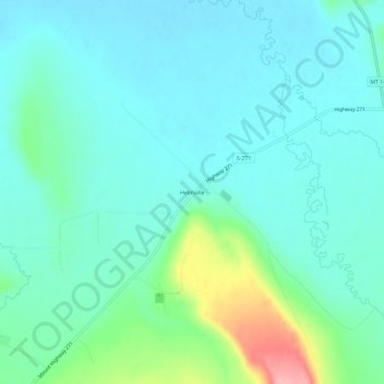
Name: Helmville topographic map, elevation, terrain.
Location: Helmville, Powell County, Montana, 59843, United States (46.84660 -112.98116 46.88660 -112.94116)
Average elevation: 1,323 m
Minimum elevation: 1,297 m
Maximum elevation: 1,420 m
Thank you for supporting this site ❤️
Make a donation
Make a donation
Other topographic maps
Click on a map to view its topography, its elevation and its terrain.