
Sumber Lor topographic map
Click on the map to display elevation.
About this map
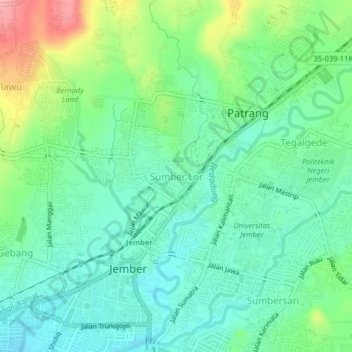
Name: Sumber Lor topographic map, elevation, terrain.
Location: Sumber Lor, Jember, East Java, Java, 68118, Indonesia (-8.17848 113.68773 -8.13848 113.72773)
Average elevation: 109 m
Minimum elevation: 71 m
Maximum elevation: 199 m
Other topographic maps
Click on a map to view its topography, its elevation and its terrain.