
Thank you for supporting this site ❤️
Make a donation
Make a donation
O Barco de Valdeorras topographic map
Click on the map to display elevation.
Thank you for supporting this site ❤️
Make a donation
Make a donation
About this map
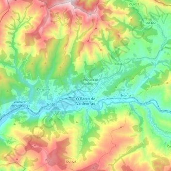
Name: O Barco de Valdeorras topographic map, elevation, terrain.
Location: O Barco de Valdeorras, Valdeorras, Ourense, Galicia, Spain (42.35455 -7.04309 42.50570 -6.90499)
Average elevation: 769 m
Minimum elevation: 297 m
Maximum elevation: 1,608 m
Thank you for supporting this site ❤️
Make a donation
Make a donation
Other topographic maps
Click on a map to view its topography, its elevation and its terrain.