
Thank you for supporting this site ❤️
Make a donation
Make a donation
Al Qurayyat topographic map
Click on the map to display elevation.
Thank you for supporting this site ❤️
Make a donation
Make a donation
About this map
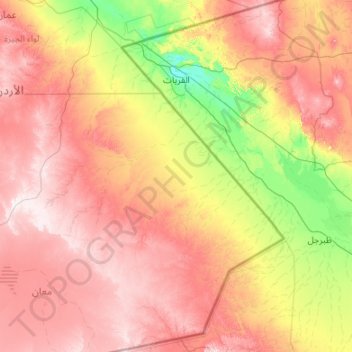
Name: Al Qurayyat topographic map, elevation, terrain.
Location: Al Qurayyat, Al Jawf Region, Saudi Arabia (29.90521 37.00617 31.74510 38.40298)
Average elevation: 727 m
Minimum elevation: 486 m
Maximum elevation: 1,052 m
Thank you for supporting this site ❤️
Make a donation
Make a donation
Other topographic maps
Click on a map to view its topography, its elevation and its terrain.
Thank you for supporting this site ❤️
Make a donation
Make a donation
Thank you for supporting this site ❤️
Make a donation
Make a donation