
Thank you for supporting this site ❤️
Make a donation
Make a donation
Ronneby kommun topographic map
Click on the map to display elevation.
Thank you for supporting this site ❤️
Make a donation
Make a donation
About this map
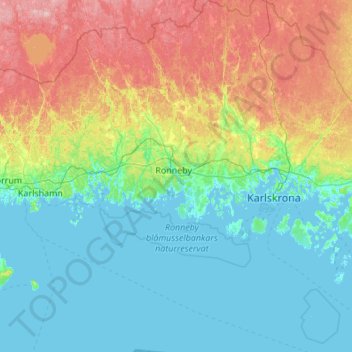
Name: Ronneby kommun topographic map, elevation, terrain.
Location: Ronneby kommun, Blekinge County, Sweden (55.89404 14.93062 56.50061 15.52399)
Average elevation: 45 m
Minimum elevation: -2 m
Maximum elevation: 183 m
Thank you for supporting this site ❤️
Make a donation
Make a donation