
Río Chiriquí topographic map
Interactive map
Click on the map to display elevation.
About this map
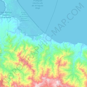
Name: Río Chiriquí topographic map, elevation, terrain.
Location: Río Chiriquí, Distrito Kusapín, Ngäbe-Buglé, Panamá (8.58474 -81.72448 9.01240 -81.46596)
Average elevation: 347 m
Minimum elevation: -1 m
Maximum elevation: 1,921 m