
Thank you for supporting this site ❤️
Make a donation
Make a donation
Marcianise topographic map
Click on the map to display elevation.
Thank you for supporting this site ❤️
Make a donation
Make a donation
About this map
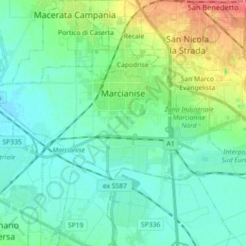
Name: Marcianise topographic map, elevation, terrain.
Location: Marcianise, Caserta, Campania, 81025, Italy (40.99963 14.23115 41.04351 14.35655)
Average elevation: 29 m
Minimum elevation: 14 m
Maximum elevation: 74 m
Thank you for supporting this site ❤️
Make a donation
Make a donation
Other topographic maps
Click on a map to view its topography, its elevation and its terrain.