
Conty topographic map
Click on the map to display elevation.
About this map
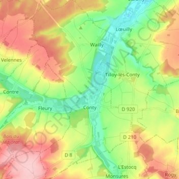
Name: Conty topographic map, elevation, terrain.
Average elevation: 109 m
Minimum elevation: 41 m
Maximum elevation: 195 m
Other topographic maps
Click on a map to view its topography, its elevation and its terrain.
Beaumont-Hamel Newfoundland Memorial Park
France > Hauts-de-France > Somme > Beaumont-Hamel
Average elevation: 127 m