
Thank you for supporting this site ❤️
Make a donation
Make a donation
Montague Island topographic map
Click on the map to display elevation.
Thank you for supporting this site ❤️
Make a donation
Make a donation
About this map
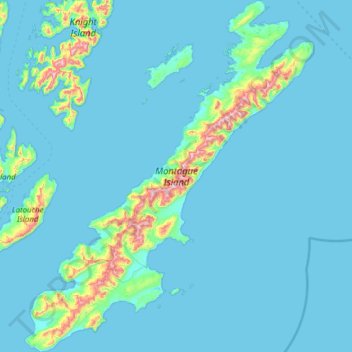
Name: Montague Island topographic map, elevation, terrain.
Location: Montague Island, Chugach, Alaska, United States (59.76334 -147.93230 60.38091 -146.91433)
Average elevation: 55 m
Minimum elevation: -3 m
Maximum elevation: 885 m
Thank you for supporting this site ❤️
Make a donation
Make a donation
Other topographic maps
Click on a map to view its topography, its elevation and its terrain.