
Passau topographic map
Interactive map
Click on the map to display elevation.
About this map
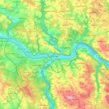
Name: Passau topographic map, elevation, terrain.
Location: Passau, Bavière, Allemagne (48.54045 13.30234 48.61342 13.51439)
Average elevation: 401 m
Minimum elevation: 282 m
Maximum elevation: 585 m