
Ratisbonne topographic map
Interactive map
Click on the map to display elevation.
About this map
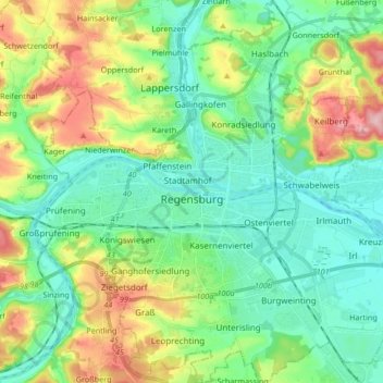
Name: Ratisbonne topographic map, elevation, terrain.
Location: Ratisbonne, Bavière, Allemagne (48.96675 12.02907 49.07642 12.19161)
Average elevation: 371 m
Minimum elevation: 322 m
Maximum elevation: 483 m