
Cútar topographic map
Interactive map
Click on the map to display elevation.
About this map
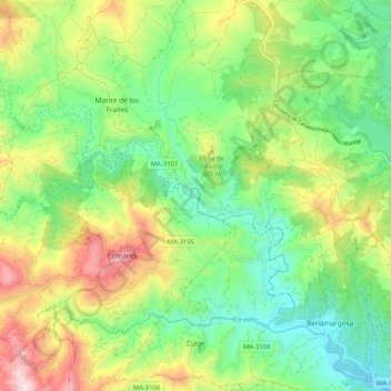
Name: Cútar topographic map, elevation, terrain.
Location: Cútar, La Axarquía, Malaga, Andalusia, Spain (36.82087 -4.25994 36.90285 -4.20282)
Average elevation: 336 m
Minimum elevation: 70 m
Maximum elevation: 805 m