
Thank you for supporting this site ❤️
Make a donation
Make a donation
Cranes Mill topographic map
Click on the map to display elevation.
Thank you for supporting this site ❤️
Make a donation
Make a donation
About this map
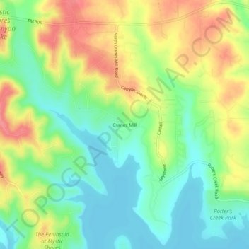
Name: Cranes Mill topographic map, elevation, terrain.
Location: Cranes Mill, Comal County, Texas, 79133, United States (29.90077 -98.31029 29.94077 -98.27029)
Average elevation: 308 m
Minimum elevation: 275 m
Maximum elevation: 353 m
Thank you for supporting this site ❤️
Make a donation
Make a donation
Other topographic maps
Click on a map to view its topography, its elevation and its terrain.