
Plaine des Grègues topographic map
Interactive map
Click on the map to display elevation.
About this map
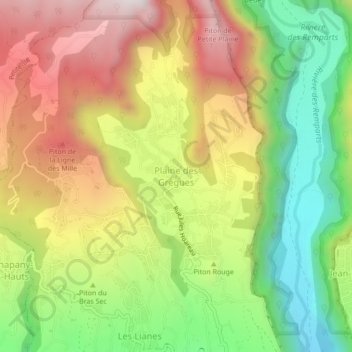
Name: Plaine des Grègues topographic map, elevation, terrain.
Location: Plaine des Grègues, Saint-Pierre, La Réunion, 97480, France (-21.34781 55.58735 -21.30781 55.62735)
Average elevation: 649 m
Minimum elevation: 169 m
Maximum elevation: 1,173 m