
Thank you for supporting this site ❤️
Make a donation
Make a donation
Prek Ambel topographic map
Click on the map to display elevation.
Thank you for supporting this site ❤️
Make a donation
Make a donation
About this map
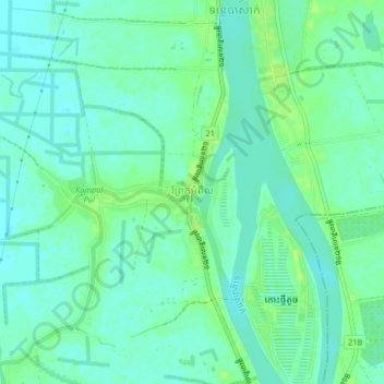
Name: Prek Ambel topographic map, elevation, terrain.
Location: Prek Ambel, S'ang District, Kandal, Cambodia (11.22409 105.00496 11.26409 105.04496)
Average elevation: 7 m
Minimum elevation: 1 m
Maximum elevation: 15 m
Thank you for supporting this site ❤️
Make a donation
Make a donation