
Thank you for supporting this site ❤️
Make a donation
Make a donation
Cave City topographic map
Click on the map to display elevation.
Thank you for supporting this site ❤️
Make a donation
Make a donation
About this map
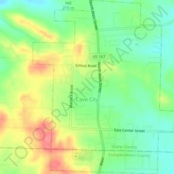
Name: Cave City topographic map, elevation, terrain.
Location: Cave City, Sharp County, Arkansas, 72521, United States (35.93410 -91.56276 35.96399 -91.52890)
Average elevation: 205 m
Minimum elevation: 175 m
Maximum elevation: 244 m
Thank you for supporting this site ❤️
Make a donation
Make a donation
Other topographic maps
Click on a map to view its topography, its elevation and its terrain.