
Thank you for supporting this site ❤️
Make a donation
Make a donation
Panalipan topographic map
Click on the map to display elevation.
Thank you for supporting this site ❤️
Make a donation
Make a donation
About this map
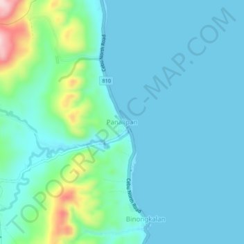
Name: Panalipan topographic map, elevation, terrain.
Location: Panalipan, Catmon, Cebu, Central Visayas, Philippines (10.63005 124.00392 10.67005 124.04392)
Average elevation: 43 m
Minimum elevation: 0 m
Maximum elevation: 259 m
Thank you for supporting this site ❤️
Make a donation
Make a donation
Other topographic maps
Click on a map to view its topography, its elevation and its terrain.