
Erla topographic map
Interactive map
Click on the map to display elevation.
About this map
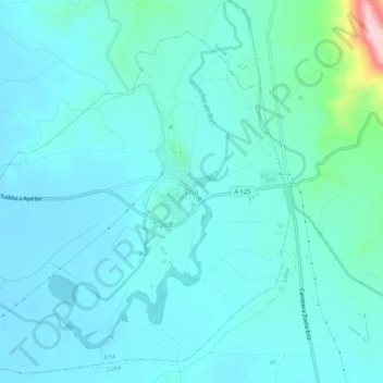
Name: Erla topographic map, elevation, terrain.
Location: Erla, Cinco Villas, Saragossa, Aragonien, Spanien (42.09500 -0.96763 42.13500 -0.92763)
Average elevation: 422 m
Minimum elevation: 387 m
Maximum elevation: 659 m