
Thank you for supporting this site ❤️
Make a donation
Make a donation
Kea topographic map
Click on the map to display elevation.
Thank you for supporting this site ❤️
Make a donation
Make a donation
About this map
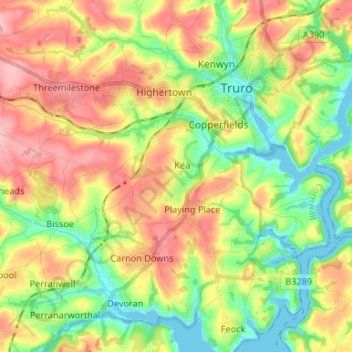
Name: Kea topographic map, elevation, terrain.
Location: Kea, Cornwall, England, United Kingdom (50.22219 -5.14749 50.26174 -5.01502)
Average elevation: 54 m
Minimum elevation: -1 m
Maximum elevation: 118 m
Thank you for supporting this site ❤️
Make a donation
Make a donation