
Hoher Göll topographic map
Interactive map
Click on the map to display elevation.
About this map
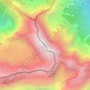
Name: Hoher Göll topographic map, elevation, terrain.
Location: Hoher Göll, Kuchl, Bezirk Hallein, Salzburg, 5431, Österreich (47.59388 13.06709 47.59398 13.06719)
Average elevation: 1,904 m
Minimum elevation: 976 m
Maximum elevation: 2,495 m