
Starogard County topographic map
Interactive map
Click on the map to display elevation.
About this map
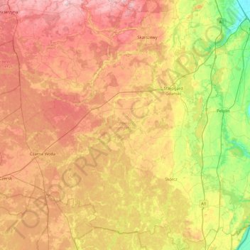
Name: Starogard County topographic map, elevation, terrain.
Location: Starogard County, Pomeranian Voivodeship, Poland (53.65509 18.06351 54.14314 18.73472)
Average elevation: 108 m
Minimum elevation: 1 m
Maximum elevation: 227 m
Other topographic maps
Click on a map to view its topography, its elevation and its terrain.
Skarszewy
Poland > Pomeranian Voivodeship > Starogard County
Skarszewy, gmina Skarszewy, Starogard County, Pomeranian Voivodeship, 83-250, Poland
Average elevation: 126 m