
Thank you for supporting this site ❤️
Make a donation
Make a donation
Lette topographic map
Click on the map to display elevation.
Thank you for supporting this site ❤️
Make a donation
Make a donation
About this map
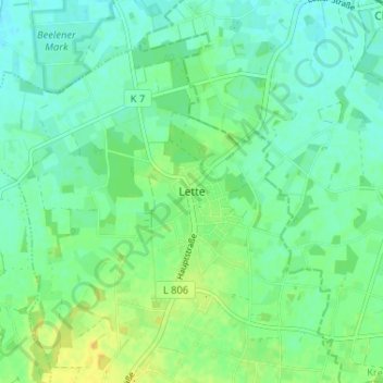
Name: Lette topographic map, elevation, terrain.
Location: Lette, Oelde, Kreis Warendorf, Nordrhein-Westfalen, Deutschland (51.86318 8.13931 51.90318 8.17931)
Average elevation: 72 m
Minimum elevation: 64 m
Maximum elevation: 85 m
Thank you for supporting this site ❤️
Make a donation
Make a donation