
Thank you for supporting this site ❤️
Make a donation
Make a donation
Vega Alta topographic map
Click on the map to display elevation.
Thank you for supporting this site ❤️
Make a donation
Make a donation
About this map
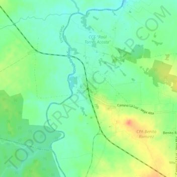
Name: Vega Alta topographic map, elevation, terrain.
Location: Vega Alta, Villa Clara, Cuba (22.52972 -79.83908 22.56972 -79.79908)
Average elevation: 47 m
Minimum elevation: 29 m
Maximum elevation: 77 m
Thank you for supporting this site ❤️
Make a donation
Make a donation
Other topographic maps
Click on a map to view its topography, its elevation and its terrain.