
Thank you for supporting this site ❤️
Make a donation
Make a donation
Mendoza Fría topographic map
Click on the map to display elevation.
Thank you for supporting this site ❤️
Make a donation
Make a donation
About this map
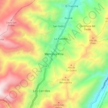
Name: Mendoza Fría topographic map, elevation, terrain.
Average elevation: 1,607 m
Minimum elevation: 818 m
Maximum elevation: 2,518 m
Thank you for supporting this site ❤️
Make a donation
Make a donation
Other topographic maps
Click on a map to view its topography, its elevation and its terrain.
Parroquia Juan Ignacio Montilla
Venezuela > Estado Trujillo > Municipio Valera
Average elevation: 606 m
Thank you for supporting this site ❤️
Make a donation
Make a donation