
Thank you for supporting this site ❤️
Make a donation
Make a donation
Ellumandam topographic map
Click on the map to display elevation.
Thank you for supporting this site ❤️
Make a donation
Make a donation
About this map
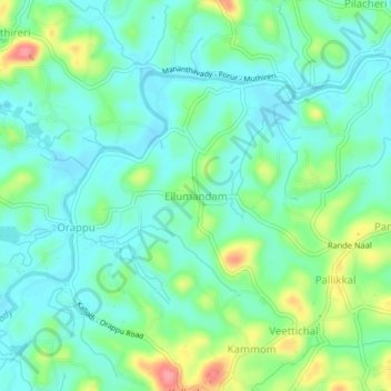
Name: Ellumandam topographic map, elevation, terrain.
Location: Ellumandam, Mananthavady, Wayanad, Kerala, 670645, India (11.76586 75.94229 11.80586 75.98229)
Average elevation: 741 m
Minimum elevation: 716 m
Maximum elevation: 806 m
Thank you for supporting this site ❤️
Make a donation
Make a donation
Other topographic maps
Click on a map to view its topography, its elevation and its terrain.