
Thank you for supporting this site ❤️
Make a donation
Make a donation
Kleve topographic map
Click on the map to display elevation.
Thank you for supporting this site ❤️
Make a donation
Make a donation
About this map
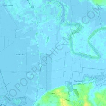
Name: Kleve topographic map, elevation, terrain.
Location: Kleve, Eider, Dithmarschen, Sleeswijk-Holstein, Duitsland (54.28743 9.10870 54.35211 9.15461)
Average elevation: 1 m
Minimum elevation: -3 m
Maximum elevation: 19 m
Thank you for supporting this site ❤️
Make a donation
Make a donation