
Thank you for supporting this site ❤️
Make a donation
Make a donation
Rolling Meadows topographic map
Click on the map to display elevation.
Thank you for supporting this site ❤️
Make a donation
Make a donation
About this map
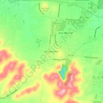
Name: Rolling Meadows topographic map, elevation, terrain.
Average elevation: 226 m
Minimum elevation: 152 m
Maximum elevation: 311 m
Thank you for supporting this site ❤️
Make a donation
Make a donation
Other topographic maps
Click on a map to view its topography, its elevation and its terrain.
Carrington Hills Pond
United States > Tennessee > Williamson County > Franklin
Average elevation: 224 m