
Moosonee topographic map
Interactive map
Click on the map to display elevation.
About this map
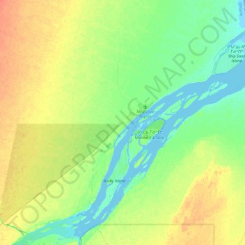
Name: Moosonee topographic map, elevation, terrain.
Average elevation: 13 m
Minimum elevation: -5 m
Maximum elevation: 31 m
Other topographic maps
Click on a map to view its topography, its elevation and its terrain.
Timmins
Canada > Ontario > Cochrane District
Timmins, Cochrane District, Northeastern Ontario, Ontario, Canada
Average elevation: 302 m
Black River-Matheson Township
Canada > Ontario > Cochrane District
Black River-Matheson Township, Cochrane District, Northeastern Ontario, Ontario, Canada
Average elevation: 306 m