
Thành phố Quảng Ngãi topographic map
Interactive map
Click on the map to display elevation.
About this map
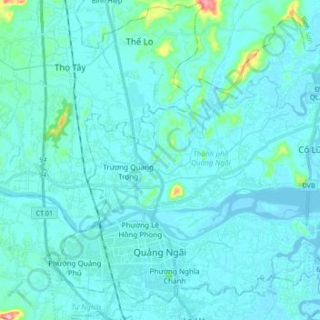
Name: Thành phố Quảng Ngãi topographic map, elevation, terrain.
Location: Thành phố Quảng Ngãi, Tỉnh Quảng Ngãi, Vietnam (15.09330 108.75885 15.23536 108.92266)
Average elevation: 14 m
Minimum elevation: -3 m
Maximum elevation: 164 m
Other topographic maps
Click on a map to view its topography, its elevation and its terrain.